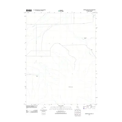
2012 Map of Observation Peak
USGS Topo · Published 2012About this map
Observation Peak anchors this high-desert landscape in Lassen County, where the transition from ranching heritage to modern topography is clearly defined. The terrain is marked by essential water sources such as Pothole Spring, Cold Spring Cr, and Painters Cr, which likely sustained the isolated operations of Madeline Ranch and Horne Ranch. A network of unpaved thoroughfares reveals the historical movement of goods and information, with routes like Mail Route Rd and Stage Rd cutting across the sagebrush-covered plains. The deep incision of Buckhorn Canyon provides a stark contrast to the surrounding flats. This survey by the U.S. Geological Survey captures a sparsely populated but geographically significant portion of Northern California, showing the enduring reliance on family ranches and named roads like Garate Rd and Horn Rd to navigate the interior plateau.
Find a feature on this map
12 named features on this map. Tap any name to fly to it.
Don’t see what you’re looking for? This feature index may not catch every label — zoom into the map to look around manually.
Map Details
Editions of this 2012 Observation Peak Map
This is the sole edition of this map. No revisions or reprints were ever made.
Other maps of this area

1886 · Honey Lake
USGS Topo · 1:250,000

1891 · Honey Lake
USGS Topo · 1:250,000

1893 · Honey Lake
USGS Topo · 1:250,000

1954 · Observation Peak
USGS Topo · 1:62,500

1954 · Karlo
USGS Topo · 1:62,500

1954 · Ravendale
USGS Topo · 1:62,500

1954 · Shinn Mountain
USGS Topo · 1:62,500

1955 · Westwood
USGS Topo · 1:250,000

1958 · Westwood
USGS Topo · 1:250,000

1959 · Westwood
USGS Topo · 1:250,000