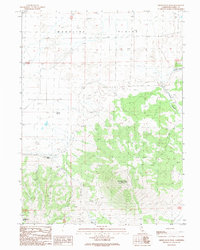
1989 Map of Observation Peak
USGS Topo · Published 1989About this map
Madeline Plains dominates the northern expanse of this Lassen County landscape, where the flat basin meets the rising slopes of the Skedaddle Mountains. The most prominent landmark is Observation Peak, reaching nearly 8,000 feet and topped by the Observation Peak Lookout Tower, providing a strategic vantage point over the high desert terrain. Water sources are critical in this arid environment, marked by several distinct sites such as Pothole Spring, Cottonwood Spring, and the drainage of Painters Creek. Human presence is sparse, centered on the Madeline Ranch and a network of 4wd tracks that navigate the foothills. A small Cem is located near the eastern edge of the quadrangle, while a Borrow Pit and a long Levee suggest the ongoing management of the plains' limited resources and drainage patterns during the late 1980s.
Find a feature on this map
17 named features on this map. Tap any name to fly to it.
Don’t see what you’re looking for? This feature index may not catch every label — zoom into the map to look around manually.
Map Details
Editions of this 1989 Observation Peak Map
This is the sole edition of this map. No revisions or reprints were ever made.
Other maps of this area

1886 · Honey Lake
USGS Topo · 1:250,000

1891 · Honey Lake
USGS Topo · 1:250,000

1893 · Honey Lake
USGS Topo · 1:250,000

1954 · Observation Peak
USGS Topo · 1:62,500

1954 · Karlo
USGS Topo · 1:62,500

1954 · Ravendale
USGS Topo · 1:62,500

1954 · Shinn Mountain
USGS Topo · 1:62,500

1955 · Westwood
USGS Topo · 1:250,000

1958 · Westwood
USGS Topo · 1:250,000

1959 · Westwood
USGS Topo · 1:250,000