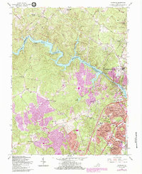
1956 Map of Occoquan
USGS Topo · Published 1984About this map
The Occoquan River and its accompanying Occoquan Reservoir form the central geographic spine of this Northern Virginia landscape, dividing Fairfax and Prince William counties. This mid-century survey captures the region during a period of significant suburban expansion, evidenced by the emerging street grids of Dale City, Marumsco Village, and Marumsco Woods. While new developments like Lakewood Estates appear, older rural nodes such as Hoadly, Bethel, and Agnewville remain distinct.
Find a feature on this map
92 named features on this map. Tap any name to fly to it.
Don’t see what you’re looking for? This feature index may not catch every label — zoom into the map to look around manually.
Map Details
Editions of this 1956 Occoquan Map
4 editions found
Other maps of this area

1890 · Mt. Vernon
USGS Topo · 1:125,000

1891 · Mt. Vernon
USGS Topo · 1:125,000

1894 · Mt. Vernon
USGS Topo · 1:125,000

1897 · Mt. Vernon
USGS Topo · 1:125,000

1900 · Washington
USGS Topo · 1:62,500

1913 · Indian Head
USGS Topo · 1:62,500

1915 · Fairfax
USGS Topo · 1:62,500

1923 · Indian Head
USGS Topo · 1:48,000

1925 · Indian Head
USGS Topo · 1:62,500

1927 · Quantico
USGS Topo · 1:62,500