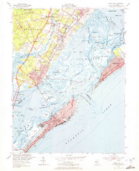
1952 Map of Ocean City
USGS Topo · Published 1972About this map
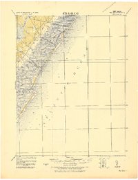
The complex tidal network of Great Egg Harbor Bay and its surrounding coastal communities are documented here during a period of mid-century development. Post-war expansion is evident in the residential grids of Ocean City and Margate City, while the Pennsylvania-Reading Seashore Lines still serves as a vital transit artery across the salt marshes and inlets. The map illustrates the precarious balance between settlement and sea, featuring the Great Egg Harbor Inlet and the expansive salt marshes surrounding Rainbow Islands. Inland, older settlements like Bargaintown and Northfield provide a look at the established landscape before the full impact of the Garden State Parkway, which is shown here under construction. Notable local landmarks include the Ocean City Airport and the Municipal Pier, anchoring the resort's economy to both air and sea.
Find a feature on this map
79 named features on this map. Tap any name to fly to it.
Don’t see what you’re looking for? This feature index may not catch every label — zoom into the map to look around manually.
Map Details
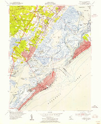
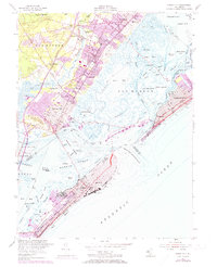
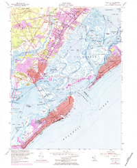
Editions of this 1952 Ocean City Map
4 editions found
Other maps of this area

1884 · Sea Isle
USGS Topo · 1:62,500

1887 · Atlantic City
USGS Topo · 1:62,500

1888 · Sea Isle
USGS Topo · 1:62,500

1890 · Great Egg Harbor
USGS Topo · 1:62,500

1893 · Great Egg Harbor
USGS Topo · 1:62,500

1894 · Sea Isle
USGS Topo · 1:62,500

1894 · Atlantic City
USGS Topo · 1:62,500

1918 · Great Egg Harbor
USGS Topo · 1:62,500
1919 · Sea Isle
USGS Topo · 1:62,500

1940 · Atlantic City
USGS Topo · 1:62,500