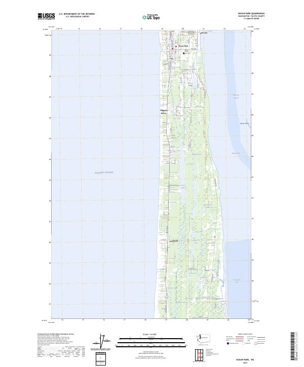
2023 Map of Ocean Park
USGS Topo · Published 2023About this map
The North Beach Peninsula is defined by its narrow geography, squeezed between the Pacific Ocean to the west and the expansive Willapa Bay to the east. This survey documents the modern settlement patterns of Pacific County, where communities like Ocean Park, Nahcotta, and Klipsan Beach are linked by Pacific Way and Sandridge Rd. The landscape is a complex network of freshwater and brackish environments, including numerous named bodies of water such as Loomis Lake, Cranberry Lake, and Clam Lake. Much of the eastern shoreline and the southern portion of the sheet are protected within the Willapa National Wildlife Refuge, preserving habitats like Cranberry Marsh and Giles Slough. For local historians and genealogists, the Ocean Park Cem and the residential grids of Oceanside offer specific points of interest on this thin strip of coastal Washington.
Find a feature on this map
48 named features on this map. Tap any name to fly to it.
Don’t see what you’re looking for? This feature index may not catch every label — zoom into the map to look around manually.
Map Details
Editions of this 2023 Ocean Park Map
This is the sole edition of this map. No revisions or reprints were ever made.
Other maps of this area

1938 · Cape Disappointment
USGS Topo · 1:62,500

1938 · Cape Shoalwater
USGS Topo · 1:62,500

1938 · Fort Columbia
USGS Topo · 1:62,500

1938 · South Bend
USGS Topo · 1:62,500

1940 · South Bend
USGS Topo · 1:62,500

1943 · Fort Columbia
USGS Topo · 1:62,500

1943 · Copalis Beach
USGS Topo · 1:250,000

1949 · Chinook
USGS Topo · 1:24,000

1949 · Ocean Park
USGS Topo · 1:24,000

1949 · Long Island
USGS Topo · 1:24,000