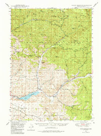
1950 Map of Ochoco Reservoir
USGS Topo · Published 1985About this map
Ochoco National Forest dominates this landscape in central Oregon, where the high desert meets the western edge of the Blue Mountains. The terrain is defined by dramatic volcanic features and landmarks like Steins Pillar and Hash Rock. Local water management is central to the area's development, anchored by the Ochoco Reservoir and the Spillway on Ochoco Creek. The map documents a rural network of ranching and forestry operations, including the Keystone Ranch and Slayton Corral.
Find a feature on this map
76 named features on this map. Tap any name to fly to it.
Don’t see what you’re looking for? This feature index may not catch every label — zoom into the map to look around manually.
Map Details
Editions of this 1950 Ochoco Reservoir Map
4 editions found
Other maps of this area

1926 · Mitchell
USGS Topo · 1:125,000

1946 · Eagle Rock
USGS Topo · 1:62,500

1948 · Eagle Rock
USGS Topo · 1:62,500

1948 · Ochoco Reservoir
USGS Topo · 1:62,500

1950 · Ochoco Reservoir
USGS Topo · 1:62,500

1951 · Post
USGS Topo · 1:62,500

1951 · Lookout Mtn
USGS Topo · 1:62,500

1955 · Bend
USGS Topo · 1:250,000

1957 · Bend
USGS Topo · 1:250,000

1958 · Bend
USGS Topo · 1:250,000