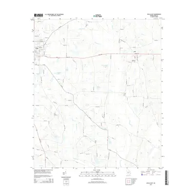
2014 Map of Ocilla East
USGS Topo · Published 2014About this map
Ocilla and the surrounding agricultural landscape of Irwin County are defined by a complex network of wetlands and creek beds in this 2014 survey. The town's structured grid, anchored by the City Cemetery, transitions eastward into a terrain dominated by the winding paths of Willacoochee Creek and Satilla Creek. This map highlights a rural settlement pattern where genealogy takes center stage, marked by several family and community burial grounds including Whitleys Cemetery, Paulk Cemetery, and Henderson Chapel Cemetery. The southern reaches of the quadrangle follow the meandering Willacoochee River as it carves through the low-lying plains. Numerous small bodies of water, such as Shiver Lake S and E Paulk Lake, dot the landscape between the Douglas Highway and the Lax Highway, illustrating the local hydrology that has shaped farming and land use in this part of Georgia for generations.
Find a feature on this map
95 named features on this map. Tap any name to fly to it.
Don’t see what you’re looking for? This feature index may not catch every label — zoom into the map to look around manually.
Map Details
Editions of this 2014 Ocilla East Map
This is the sole edition of this map. No revisions or reprints were ever made.
Other maps of this area

1953 · Waycross
USGS Topo · 1:250,000

1958 · Waycross
USGS Topo · 1:250,000

1972 · Fitzgerald East
USGS Topo · 1:24,000

1972 · Lax
USGS Topo · 1:24,000

1972 · Ambrose
USGS Topo · 1:24,000

1972 · Ocilla East
USGS Topo · 1:24,000

1973 · Ocilla West
USGS Topo · 1:24,000

1973 · Enigma
USGS Topo · 1:24,000

1973 · Fitzgerald West
USGS Topo · 1:24,000

1977 · Osierfield
USGS Topo · 1:24,000