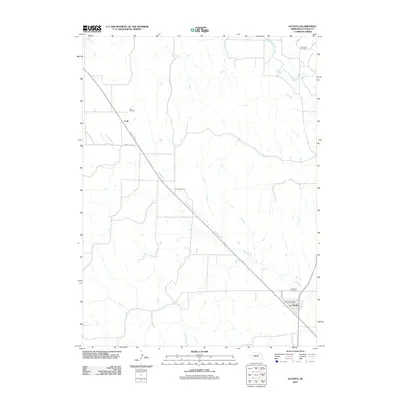
2011 Map of Oconto
USGS Topo · Published 2011About this map
The South Loup River winds through the northern reaches of this central Nebraska landscape, which is defined by the sparse, agrarian settlement patterns of Custer County. In the southern portion of the sheet, the village of Oconto serves as a local hub, anchored by the Oconto Post Office. The map traces the diagonal path of the Wood River as it cuts across the township, flanked by thoroughfares like Wood River Rd and the town-centered Railroad St. Genealogists will find significant local history in the distribution of rural burial grounds, including Lodi Cemetery near the settlement of Lodi and the Saint Mary Cemetery closer to the village. These features, along with Riverside Cemetery near the riverbanks, provide a clear record of the communities that have persisted in this prairie environment into the twenty-first century.
Find a feature on this map
9 named features on this map. Tap any name to fly to it.
Don’t see what you’re looking for? This feature index may not catch every label — zoom into the map to look around manually.
Map Details
Editions of this 2011 Oconto Map
This is the sole edition of this map. No revisions or reprints were ever made.
Other maps of this area

1951 · Broken Bow SW
USGS Topo · 1:24,000

1951 · Callaway SE
USGS Topo · 1:24,000

1951 · Callaway
USGS Topo · 1:24,000

1951 · Oconto SW
USGS Topo · 1:24,000

1951 · Eddyville NW
USGS Topo · 1:24,000

1951 · Oconto SE
USGS Topo · 1:24,000

1951 · Eddyville SW
USGS Topo · 1:24,000

1951 · Oconto NW
USGS Topo · 1:24,000

1951 · Oconto
USGS Topo · 1:24,000

1955 · Broken Bow
USGS Topo · 1:250,000