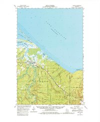
1964 Map of Odanah
USGS Topo · Published 1980About this map
Odanah stands as the primary settlement within the Bad River Indian Res Bdy in this mid-1960s study of the Lake Superior shoreline. The landscape is defined by an intricate network of waterways where the Bad River and White River converge before entering the lake. The coastal geography is particularly complex, featuring the long, slender reach of Chequamegon Point sheltering Chequamegon Bay, alongside numerous wetlands like Kakagon Slough and Hansen Swamp.
Find a feature on this map
42 named features on this map. Tap any name to fly to it.
Don’t see what you’re looking for? This feature index may not catch every label — zoom into the map to look around manually.
Map Details
Editions of this 1964 Odanah Map
2 editions found
Other maps of this area

1940 · Upson
USGS Topo · 1:48,000

1941 · Bayfield
USGS Topo · 1:48,000

1942 · Ashland
USGS Topo · 1:48,000

1942 · Mellen
USGS Topo · 1:48,000

1942 · Marengo
USGS Topo · 1:48,000

1943 · Upson
USGS Topo · 1:48,000

1943 · Little Girl Point
USGS Topo · 1:48,000

1943 · Odanah
USGS Topo · 1:48,000

1945 · Odanah
USGS Topo · 1:48,000

1945 · Marengo
USGS Topo · 1:48,000