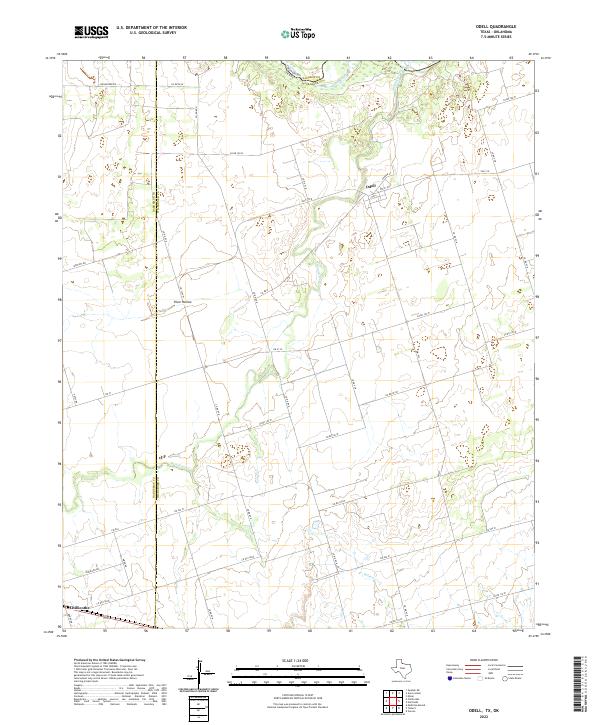
2022 Map of Odell
USGS Topo · Published 2022About this map
The Red River defines the northern boundary of this Texas panhandle landscape, marking the historic border between Oklahoma and Texas. The rural settlement of Odell serves as a central hub for a network of farm-to-market roads and county lines, including the junction of FM 2379 W and FM 91 W. Further south, the town of Chillicothe sits along the southern edge of the survey, where the path of Route 287 crosses the plains. The terrain is characterized by the winding drainage systems of Wanderers Cr and Wildcat Cr, which cut through the agricultural grid. Smaller named locales like Plum Hollow highlight the traditional cattle and farming communities of Wilbarger County during the early 21st century. The map detail preserves the exact placement of rural infrastructure, from Heilhecker RD in the north to the many numbered county roads that provide access to this ranching country.
Find a feature on this map
36 named features on this map. Tap any name to fly to it.
Don’t see what you’re looking for? This feature index may not catch every label — zoom into the map to look around manually.
Map Details
Editions of this 2022 Odell Map
This is the sole edition of this map. No revisions or reprints were ever made.
Other maps of this area

1955 · Lawton
USGS Topo · 1:250,000

1958 · Vernon
USGS Topo · 1:62,500

1958 · Medicine Mound
USGS Topo · 1:62,500

1958 · Elmer
USGS Topo · 1:62,500

1960 · Quanah
USGS Topo · 1:62,500

1975 · Elmore City NE
USGS Topo · 1:24,000

1975 · Quanah NE
USGS Topo · 1:24,000

1983 · Tolbert
USGS Topo · 1:24,000
1983 · Vernon
USGS Topo · 1:24,000
1983 · Medicine Mound
USGS Topo · 1:24,000