2016 Map of Odem
USGS Topo · Published 2016About this map
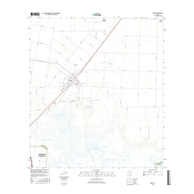
The town of Odem serves as the focal point for this survey of the San Patricio and Nueces county borderlands, where agricultural patterns meet the hydrologic systems of the coastal bend. The layout of the town is defined by a grid including Main St and W Willis St, situated just west of the channel of Peters Swale. This landscape is characterized by its transition from organized farmland near Morgan Farm to the intricate marshlands of the Rincon Bayou and the broader waters of Nueces Bay. Genealogists will find several notable local burial sites, including Evergreen Cem, San Pedro Cem, and Bethel Cem. The Nueces River marks the southern reach of the map, carving through the wetland terrain as it approaches the outskirts of Corpus Christi. A network of rural routes such as Sodville Rd and FM 1944 connects the outlying settlements of Loma Linda to the regional core.
Find a feature on this map
77 named features on this map. Tap any name to fly to it.
Don’t see what you’re looking for? This feature index may not catch every label — zoom into the map to look around manually.
Map Details
Editions of this 2016 Odem Map
This is the sole edition of this map. No revisions or reprints were ever made.
Other maps of this area

1925 · Robstown
USGS Topo · 1:62,500

1925 · Corpus Christi
USGS Topo · 1:62,500

1950 · Corpus Christi
USGS Topo · 1:250,000

1951 · Corpus Christi
USGS Topo · 1:24,000

1951 · Corpus Christi
USGS Topo · 1:62,500

1953 · Beeville
USGS Topo · 1:250,000

1954 · Woodsboro
USGS Topo · 1:62,500

1954 · Robstown
USGS Topo · 1:62,500

1954 · Sinton
USGS Topo · 1:62,500

1956 · Corpus Christi
USGS Topo · 1:250,000
Featured Places
- Corpus Christi, TX
- Odem, TX
- Bethel Estates Number 2 Colonia, TX
- Friendswood Acres Number 1 Colonia, TX
- Sunrise Acres Colonia, TX