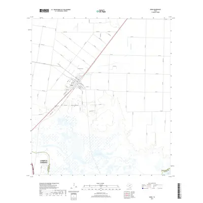
2019 Map of Odem
USGS Topo · Published 2019About this map
Odem serves as the primary hub of this landscape, situated at the junction of critical transit corridors just north of the Nueces River. The town's grid is detailed down to local streets like Main St and Cook Ave, reflecting its role as a residential and commercial center within the coastal plain. Outside the town limits, the landscape transitions into the hydrologically complex transition zone where freshwater meets the coast. The southern reaches are defined by the winding course of Rincon Bayou and the expanse of Nueces Bay, with the city limits of Corpus Christi reaching into the southwestern corner of the quadrangle.
Find a feature on this map
79 named features on this map. Tap any name to fly to it.
Don’t see what you’re looking for? This feature index may not catch every label — zoom into the map to look around manually.
Map Details
Editions of this 2019 Odem Map
This is the sole edition of this map. No revisions or reprints were ever made.
Other maps of this area

1925 · Robstown
USGS Topo · 1:62,500

1925 · Corpus Christi
USGS Topo · 1:62,500

1950 · Corpus Christi
USGS Topo · 1:250,000

1951 · Corpus Christi
USGS Topo · 1:24,000

1951 · Corpus Christi
USGS Topo · 1:62,500

1953 · Beeville
USGS Topo · 1:250,000

1954 · Woodsboro
USGS Topo · 1:62,500

1954 · Robstown
USGS Topo · 1:62,500

1954 · Sinton
USGS Topo · 1:62,500

1956 · Corpus Christi
USGS Topo · 1:250,000
Featured Places
- Corpus Christi, TX
- Odem, TX
- Bethel Estates Number 2 Colonia, TX
- Friendswood Acres Number 1 Colonia, TX
- Sunrise Acres Colonia, TX