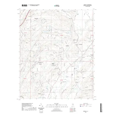
2020 Map of Odenville
USGS Topo · Published 2020About this map
Springville and Odenville anchor this northern Alabama landscape, which transitions from the ridges of the Beaver Creek Mountains into the fertile Cahaba Valley. This modern survey illustrates the contemporary settlement patterns of St. Clair County, where traditional unincorporated communities like Sanie and Turnbough Town sit alongside growing municipalities. The map's high-resolution contour data reveals a complex terrain of ridges and valleys, from the heights of Bald Rock Mtn and Jones Mtn down to the drainage basins of Big Black Cr and Little Black Cr. Local heritage is preserved through the mapping of numerous family and community burial sites, including Macedonia Cem and Austin Olds Cem. Notable aviation and recreational landmarks such as the Town & Country Airpark and several private lakes like Lake Riddle and Trucks Lake are documented, showing the area's development as a rural-residential corridor.
Find a feature on this map
196 named features on this map. Tap any name to fly to it.
Don’t see what you’re looking for? This feature index may not catch every label — zoom into the map to look around manually.
Map Details
Editions of this 2020 Odenville Map
This is the sole edition of this map. No revisions or reprints were ever made.
Other maps of this area

1889 · Springville
USGS Topo · 1:125,000

1889 · Birmingham
USGS Topo · 1:125,000

1892 · Birmingham
USGS Topo · 1:125,000

1892 · Springville
USGS Topo · 1:125,000

1895 · Birmingham
USGS Topo · 1:125,000

1905 · Leeds
USGS Topo · 1:62,500

1907 · Birmingham
USGS Topo · 1:125,000

1907 · Leeds
USGS Topo · 1:62,500

1953 · Birmingham
USGS Topo · 1:250,000

1956 · Birmingham
USGS Topo · 1:250,000