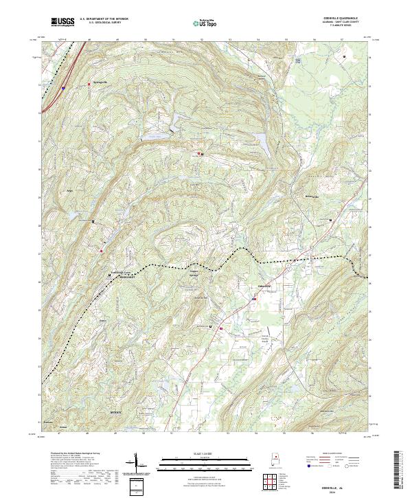
2024 Map of Odenville
USGS Topo · Published 2024About this map
Odenville and Branchville sit at the heart of this Saint Clair County landscape, where the ridges of the Appalachian foothills create a complex network of valleys and gaps. The map documents a blend of residential growth and long-standing rural landmarks, including numerous family and community burial grounds such as Austin Olds Cem and Liberty Cem. The topography is defined by parallel ridges like Backbone Mountain and Wolf Pen Ridge, which hem in the Cahaba Valley and Shoal Creek Valley. Industrial history is quietly present through the naming of Strip Mine Rd near Coal Mtn, indicating the area's geological utility. Local transport and aviation are represented by the Town & Country Airpark, while smaller named settlements like Turnbough Town and Sanie reflect the localized development patterns that characterize this part of Alabama.
Find a feature on this map
78 named features on this map. Tap any name to fly to it.
Don’t see what you’re looking for? This feature index may not catch every label — zoom into the map to look around manually.
Map Details
Editions of this 2024 Odenville Map
This is the sole edition of this map. No revisions or reprints were ever made.
Other maps of this area

1889 · Springville
USGS Topo · 1:125,000

1889 · Birmingham
USGS Topo · 1:125,000

1892 · Birmingham
USGS Topo · 1:125,000

1892 · Springville
USGS Topo · 1:125,000

1895 · Birmingham
USGS Topo · 1:125,000

1905 · Leeds
USGS Topo · 1:62,500

1907 · Birmingham
USGS Topo · 1:125,000

1907 · Leeds
USGS Topo · 1:62,500

1953 · Birmingham
USGS Topo · 1:250,000

1956 · Birmingham
USGS Topo · 1:250,000