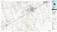
1986 Map of Odessa
USGS Topo · Published 1986About this map
Odessa and the neighboring city of Midland serve as the primary hubs in this 1986 survey of the Permian Basin. The landscape is defined by the heavy footprint of the energy industry, with extensive petroleum infrastructure visible across the South Cowden Oil Field, Goldsmith Field, and Pegasus Oil Field. These industrial zones are crisscrossed by the Texas and Pacific railroad and a grid of access roads such as the Yarbrough and Allen Field Road.
Find a feature on this map
49 named features on this map. Tap any name to fly to it.
Don’t see what you’re looking for? This feature index may not catch every label — zoom into the map to look around manually.
Map Details
Editions of this 1986 Odessa Map
2 editions found
Other maps of this area

1928 · Crane
USGS Topo · 1:125,000

1928 · Rankin
USGS Topo · 1:125,000

1931 · Barstow
USGS Topo · 1:125,000

1954 · Hobbs
USGS Topo · 1:250,000

1954 · Pecos
USGS Topo · 1:250,000

1954 · Big Spring
USGS Topo · 1:250,000

1954 · San Angelo
USGS Topo · 1:250,000

1957 · Pecos
USGS Topo · 1:250,000

1958 · San Angelo
USGS Topo · 1:250,000

1958 · Big Spring
USGS Topo · 1:250,000