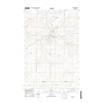
2013 Map of Odessa
USGS Topo · Published 2013About this map
Odessa serves as the central hub for this portion of the Channeled Scablands, where the valley of Crab Cr cuts through the high plateau. The town's grid is well-defined, stretching from W 2nd Ave to E 4th Ave, and includes critical local infrastructure such as the Odessa Municipal Airport and the Odessa Cem. The surrounding landscape is dominated by a systematic network of county roads named for early settler families, providing evidence of the region's agricultural heritage. Features like the Reich Windmill and numerous family-named routes such as Laney Bros Rd E and Heimbigner Rd E highlight the rural development across the Lincoln Co and Adams Co border. Beyond the town, the terrain is marked by the seasonal drainage of Duck Cr and the expansive Lakeview Ranch Loop N, illustrating the vast distances between established ranching outposts in this part of Washington.
Find a feature on this map
45 named features on this map. Tap any name to fly to it.
Don’t see what you’re looking for? This feature index may not catch every label — zoom into the map to look around manually.
Map Details
Editions of this 2013 Odessa Map
This is the sole edition of this map. No revisions or reprints were ever made.
Other maps of this area
1925 · Schrag
USGS Topo · 1:62,500
1953 · Ritzville
USGS Topo · 1:250,000
1959 · Ritzville
USGS Topo · 1:250,000
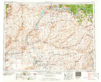
1965 · Ritzville
USGS Topo · 1:250,000
1967 · Schoonover
USGS Topo · 1:24,000
1967 · Batum
USGS Topo · 1:24,000
1967 · Reiman
USGS Topo · 1:24,000
1968 · Irby
USGS Topo · 1:24,000
1968 · Sylvan Lake
USGS Topo · 1:24,000
1968 · Coffeepot Lake
USGS Topo · 1:24,000