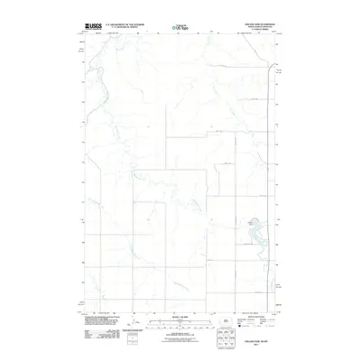
2011 Map of Odland Dam
USGS Topo · Published 2011About this map
Odland Dam forms a focal point for the drainage systems of Elmwood Township, where the waters of Little Beaver Creek meet this man-made impoundment in the southeastern corner of the quadrangle. The surrounding landscape is defined by a grid of rural roads and section lines, including 167th Ave SW and 25th ST SW, which serve the dispersed agricultural interests of the region. This survey captures the intricate network of intermittent waterways that carve through the prairie, such as the East Branch Hay Creek and Dry Creek, illustrating the natural water management of the northern plains. The presence of local access routes like Odland Dm and Odland's Dm indicates the area's significance for local transit and water access in Golden Valley County during the early 21st century.
Find a feature on this map
17 named features on this map. Tap any name to fly to it.
Don’t see what you’re looking for? This feature index may not catch every label — zoom into the map to look around manually.
Map Details
Editions of this 2011 Odland Dam Map
This is the sole edition of this map. No revisions or reprints were ever made.
Other maps of this area

1909 · Glendive
USGS Topo · 1:250,000

1953 · Miles City
USGS Topo · 1:250,000

1953 · Dickinson
USGS Topo · 1:250,000

1953 · Watford City
USGS Topo · 1:250,000

1954 · Glendive
USGS Topo · 1:250,000

1957 · Dickinson
USGS Topo · 1:250,000

1957 · Miles City
USGS Topo · 1:250,000

1957 · Glendive
USGS Topo · 1:250,000

1957 · Watford City
USGS Topo · 1:250,000

1958 · Miles City
USGS Topo · 1:250,000