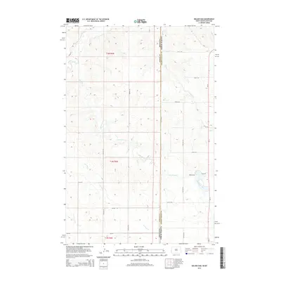
2014 Map of Odland Dam
USGS Topo · Published 2014About this map
Odland Dam sits as the central landmark in this prairie landscape, where the state line divides the plains of Wibaux County, Montana, from Golden Valley County, North Dakota. The drainage system of Little Beaver Cr and its tributaries, including Dry Cr and Beaver Cr, dominates the topography, carving subtle valleys through the high-plains terrain. The section-line road network, a signature of the American West's surveying history, is clearly established here with routes like Steele Rd and Brenizer Rd providing access to the remote ranchlands. Farther south, the headwaters of Hay Cr and the E Br Hay Cr begin their descent. This 2014 survey documents a quiet rural corridor where ND-16 serves as the primary north-south artery for local transport and commerce between these border communities.
Find a feature on this map
25 named features on this map. Tap any name to fly to it.
Don’t see what you’re looking for? This feature index may not catch every label — zoom into the map to look around manually.
Map Details
Editions of this 2014 Odland Dam Map
This is the sole edition of this map. No revisions or reprints were ever made.
Other maps of this area

1909 · Glendive
USGS Topo · 1:250,000

1953 · Miles City
USGS Topo · 1:250,000

1953 · Dickinson
USGS Topo · 1:250,000

1953 · Watford City
USGS Topo · 1:250,000

1954 · Glendive
USGS Topo · 1:250,000

1957 · Dickinson
USGS Topo · 1:250,000

1957 · Miles City
USGS Topo · 1:250,000

1957 · Glendive
USGS Topo · 1:250,000

1957 · Watford City
USGS Topo · 1:250,000

1958 · Miles City
USGS Topo · 1:250,000