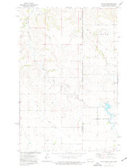
1974 Map of Odland Dam
USGS Topo · Published 1977About this map
The Little Beaver Creek drainage system dominates this mid-1970s landscape, illustrating the intricate topography along the Montana-North Dakota state line. The centerpiece is the Odland Dam, where a Picnic Area and a spillway at 2638 feet suggest a managed riparian area amidst the surrounding high ground. The survey reveals a sparsely populated ranching or farming region where a solitary Townhall and several wells serve the local community of Elmwood.
Find a feature on this map
14 named features on this map. Tap any name to fly to it.
Don’t see what you’re looking for? This feature index may not catch every label — zoom into the map to look around manually.
Map Details
Editions of this 1974 Odland Dam Map
This is the sole edition of this map. No revisions or reprints were ever made.
Other maps of this area

1909 · Glendive
USGS Topo · 1:250,000

1953 · Miles City
USGS Topo · 1:250,000

1953 · Dickinson
USGS Topo · 1:250,000

1953 · Watford City
USGS Topo · 1:250,000

1954 · Glendive
USGS Topo · 1:250,000

1957 · Dickinson
USGS Topo · 1:250,000

1957 · Miles City
USGS Topo · 1:250,000

1957 · Glendive
USGS Topo · 1:250,000

1957 · Watford City
USGS Topo · 1:250,000

1958 · Miles City
USGS Topo · 1:250,000