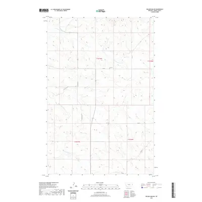
2020 Map of Odland Dam NW
USGS Topo · Published 2020About this map
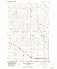
Been Cem stands as a quiet focal point in this portion of Wibaux County, where the high plains landscape is defined by the drainage systems of the N Fork Cottonwood Cr and S Fork Cottonwood Cr. This modern survey illustrates a sparse, wide-open settlement pattern typical of eastern Montana, where life and travel are dictated by a modest network of section-line roads. Named routes like Been Rd, Bell Rd, and the descriptively titled Sleepy Hollow Rd connect isolated homesteads and ranch lands across the township boundaries of T17N and T16N. The map provides a clear look at the contemporary rural infrastructure, tracing the long stretches of Cottonwood Rd as it moves through the draws and over the high divides between the creek branches.
Find a feature on this map
12 named features on this map. Tap any name to fly to it.
Don’t see what you’re looking for? This feature index may not catch every label — zoom into the map to look around manually.
Map Details
Editions of this 2020 Odland Dam NW Map
This is the sole edition of this map. No revisions or reprints were ever made.
Other maps of this area

1909 · Glendive
USGS Topo · 1:250,000

1954 · Glendive
USGS Topo · 1:250,000

1957 · Glendive
USGS Topo · 1:250,000

1958 · Glendive
USGS Topo · 1:250,000

1966 · Savage SE
USGS Topo · 1:24,000
1974 · Skaar
USGS Topo · 1:24,000
1974 · Odland Dam
USGS Topo · 1:24,000
1974 · Odland Dam NE
USGS Topo · 1:24,000

1981 · Glendive
USGS Topo · 1:100,000
1982 · Cluster Buttes SE
USGS Topo · 1:24,000