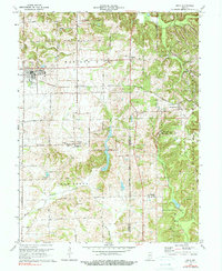
1974 Map of Odon
USGS Topo · Published 1978About this map
The town of Odon serves as the primary hub of this landscape, situated in the northwestern corner of a region defined by agricultural plots, woodlots, and scattered Oil Wells. The terrain transitions from the relatively level plains of Madison and Van Buren townships toward the more dissected ridges and valleys of Perry township to the east. A significant portion of the eastern map is occupied by the restricted grounds of the Naval Weapons Support Center, which encompasses the village of Burns City and the rugged Pigeon Ridge.
Find a feature on this map
33 named features on this map. Tap any name to fly to it.
Don’t see what you’re looking for? This feature index may not catch every label — zoom into the map to look around manually.
Map Details
Editions of this 1974 Odon Map
2 editions found
Other maps of this area

1943 · Lyons
USGS Topo · 1:24,000

1943 · Epsom
USGS Topo · 1:24,000

1944 · Montgomery
USGS Topo · 1:24,000

1950 · Shoals
USGS Topo · 1:24,000

1950 · Odon
USGS Topo · 1:24,000

1956 · Loogootee
USGS Topo · 1:24,000

1956 · Koleen
USGS Topo · 1:24,000

1956 · Indian Springs
USGS Topo · 1:24,000

1956 · Vincennes
USGS Topo · 1:250,000

1957 · Vincennes
USGS Topo · 1:250,000