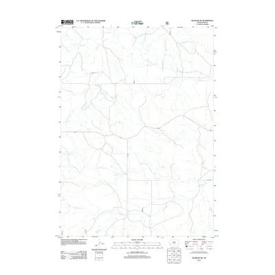
2012 Map of Oelrichs NE
USGS Topo · Published 2012About this map
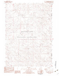
Blacktail Cr and its intricate drainage network dominate this corner of the Pine Ridge region, illustrating the complex hydrography of southwestern South Dakota. The landscape is defined by the convergence of various tributaries, including the N Fork Blacktail Cr, S Fork Blacktail Cr, and S Br Blacktail Cr, which carve seasonal paths through the terrain. Human presence is marked primarily by rural infrastructure such as Co HWY 1f and Co HWY 3, routes that provide access to the expansive open country. In the northern reaches, the geography shifts toward distinctive landmarks like Rock Butte Cr and the descriptive Middle Kneebone Draw, while School Section Cr suggests early land divisions. This survey captures a specific moment in the rural development of Oglala Lakota County, where the natural water systems remain the primary geographic features.
Find a feature on this map
10 named features on this map. Tap any name to fly to it.
Don’t see what you’re looking for? This feature index may not catch every label — zoom into the map to look around manually.
Map Details
Editions of this 2012 Oelrichs NE Map
This is the sole edition of this map. No revisions or reprints were ever made.
Other maps of this area

1896 · Oelrichs
USGS Topo · 1:125,000

1900 · Oelrichs
USGS Topo · 1:125,000

1955 · Hot Springs
USGS Topo · 1:250,000

1967 · Slim Butte SW
USGS Topo · 1:24,000

1967 · Slim Butte NW
USGS Topo · 1:24,000

1967 · Willow Creek SW
USGS Topo · 1:24,000
1982 · Smithwick
USGS Topo · 1:25,000
1982 · Oelrichs SW
USGS Topo · 1:25,000
1982 · Heinne Creek
USGS Topo · 1:25,000
1982 · Hay Canyon Butte
USGS Topo · 1:25,000