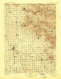
1901 Map of Oelwein
USGS Topo · Published 1926About this map
West Union and Oelwein anchor a landscape defined by the branching rail lines and river valleys of northeast Iowa at the turn of the century. The Chicago Great Western railroad serves as the primary artery for the region, connecting a network of agricultural hubs such as Maynard, Fayette, and Strawberry Point. The terrain shifts markedly from the flatter prairie in the west toward the deeply incised valleys of the Turkey River and Volga River in the northeast, where towns like Clermont, Elgin, and Wadena are situated. This survey captures a moment of established rural prosperity, showing the intersection of three counties—Fayette, Clayton, and Buchanan—as the rail-dependent economy was reaching its peak. The detailed topography illustrates how early settlements followed the natural contours of the river bends before the grid system of the iron horse reshaped the county's growth patterns.
Find a feature on this map
78 named features on this map. Tap any name to fly to it.
Don’t see what you’re looking for? This feature index may not catch every label — zoom into the map to look around manually.
Map Details
Editions of this 1901 Oelwein Map
4 editions found
Other maps of this area

1900 · Anamosa
USGS Topo · 1:125,000

1901 · Oelwein
USGS Topo · 1:125,000

1902 · Elkader
USGS Topo · 1:125,000

1903 · Waukon
USGS Topo · 1:125,000

1903 · Winthrop
USGS Topo · 1:125,000

1906 · Decorah
USGS Topo · 1:125,000

1954 · Mason City
USGS Topo · 1:250,000

1954 · Waterloo
USGS Topo · 1:250,000

1955 · Waterloo
USGS Topo · 1:250,000

1957 · Mason City
USGS Topo · 1:250,000