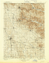
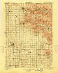
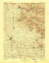
1901 Map of Oelwein
USGS Topo · Published 1944About this map
Oelwein serves as a major rail hub in this late 19th-century landscape, where the Chicago Great Western RR and other lines intersect to drive the regional economy. The geography is defined by the transition from the flat prairie in the west to the deeply dissected valleys of the Turkey River and Volga River in the northeast. This topographical shift influenced the early placement of towns like Clermont and Fayette, which were established along the waterways for power and transport.
Find a feature on this map
76 named features on this map. Tap any name to fly to it.
Don’t see what you’re looking for? This feature index may not catch every label — zoom into the map to look around manually.
Map Details
Editions of this 1901 Oelwein Map
4 editions found
Other maps of this area

1900 · Anamosa
USGS Topo · 1:125,000

1901 · Oelwein
USGS Topo · 1:125,000

1902 · Elkader
USGS Topo · 1:125,000

1903 · Waukon
USGS Topo · 1:125,000

1903 · Winthrop
USGS Topo · 1:125,000

1906 · Decorah
USGS Topo · 1:125,000

1954 · Mason City
USGS Topo · 1:250,000

1954 · Waterloo
USGS Topo · 1:250,000

1955 · Waterloo
USGS Topo · 1:250,000

1957 · Mason City
USGS Topo · 1:250,000