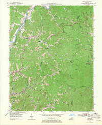
1954 Map of Offutt
USGS Topo · Published 1971About this map
Levisa Fork carves a deep valley through this corner of eastern Kentucky, defining a landscape of narrow hollows and steep ridges where small settlements clung to the river and its tributaries in the mid-1950s. The Chesapeake and Ohio railroad parallels the riverbank, serving centers like Offutt and Whitehouse. Away from the main watercourse, the map reveals a dense network of mountain schools and churches that anchored these communities, such as Butcher Hollow Sch and Wells Chapel.
Find a feature on this map
66 named features on this map. Tap any name to fly to it.
Don’t see what you’re looking for? This feature index may not catch every label — zoom into the map to look around manually.
Map Details
Editions of this 1954 Offutt Map
Other maps of this area

1886 · Prestonsburg
USGS Topo · 1:125,000

1892 · Prestonsburg
USGS Topo · 1:125,000

1914 · Laynesville
USGS Topo · 1:48,000

1914 · Inez
USGS Topo · 1:48,000

1915 · Paintsville
USGS Topo · 1:48,000

1915 · Prestonsburg
USGS Topo · 1:62,500

1916 · Harold
USGS Topo · 1:62,500

1916 · Inez
USGS Topo · 1:62,500

1917 · Paintsville
USGS Topo · 1:62,500

1918 · Prestonsburg
USGS Topo · 1:62,500