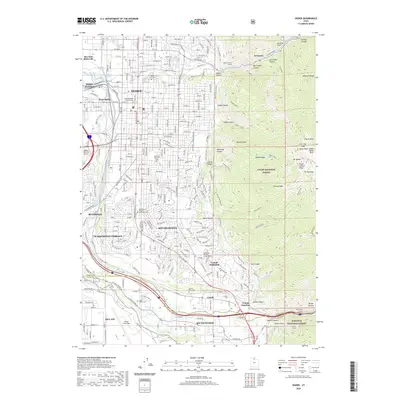
2020 Map of Ogden
USGS Topo · Published 2020About this map
The Ogden urban center and its surrounding mountain-front communities sit at the foot of the Wasatch Range, where the Ogden River and Weber River converge. This 2020 layout shows the extensive footprint of Hill Air Force Base to the south and the suburban expansion of South Ogden and South Weber. The map is particularly valuable for genealogical researchers, marking several major burial grounds including Ogden City Cem, Washington Heights Memorial Cem, and the Memorial Gardens of the Wasatch.
Find a feature on this map
70 named features on this map. Tap any name to fly to it.
Don’t see what you’re looking for? This feature index may not catch every label — zoom into the map to look around manually.
Map Details
Editions of this 2020 Ogden Map
This is the sole edition of this map. No revisions or reprints were ever made.
Other maps of this area

1954 · Ogden
USGS Topo · 1:250,000

1954 · Brigham City
USGS Topo · 1:250,000

1955 · Ogden
USGS Topo · 1:24,000

1955 · Plain City
USGS Topo · 1:24,000

1955 · Clearfield
USGS Topo · 1:24,000

1955 · Roy
USGS Topo · 1:24,000

1955 · Peterson
USGS Topo · 1:24,000

1955 · Huntsville
USGS Topo · 1:24,000

1955 · North Ogden
USGS Topo · 1:24,000

1955 · Kaysville
USGS Topo · 1:24,000