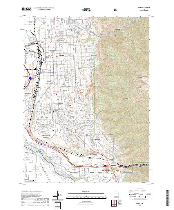
2023 Map of Ogden
USGS Topo · Published 2023About this map
Ogden and its surrounding communities are anchored by the confluence of the Ogden River and Weber River, illustrating a complex network of water management that has shaped the region's development. This survey details the intricate system of canals and conduits, including the South Ogden Highline Canal and Uintah-Central Canal, which snake through residential areas like South Ogden and Washington Terrace. To the east, the towering peaks of the Wasatch Range—including Mt Ogden and Allen Peak—provide a sharp contrast to the urban grid.
Find a feature on this map
82 named features on this map. Tap any name to fly to it.
Don’t see what you’re looking for? This feature index may not catch every label — zoom into the map to look around manually.
Map Details
Editions of this 2023 Ogden Map
This is the sole edition of this map. No revisions or reprints were ever made.
Other maps of this area

1954 · Ogden
USGS Topo · 1:250,000

1954 · Brigham City
USGS Topo · 1:250,000

1955 · Ogden
USGS Topo · 1:24,000

1955 · Plain City
USGS Topo · 1:24,000

1955 · Clearfield
USGS Topo · 1:24,000

1955 · Roy
USGS Topo · 1:24,000

1955 · Peterson
USGS Topo · 1:24,000

1955 · Huntsville
USGS Topo · 1:24,000

1955 · North Ogden
USGS Topo · 1:24,000

1955 · Kaysville
USGS Topo · 1:24,000