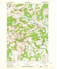
1969 Map of Ogdensburg
USGS Topo · Published 1972About this map
Ogdensburg serves as the central hub of this Waupaca County landscape, situated where the Green Bay and Western railroad corridor meets the waters of Ogdensburg Pond. The surrounding terrain of St Lawrence and Farmington townships is defined by a dense concentration of glacial kettles and small lakes, including Knutson Lake, Norby Lake, and Shambeau Lake. The industrial footprint of the era is evident through several extractive sites, such as the Quarry and various Gravel Pits scattered near the southern boundary. To the south, the Little Wolf River meanders through the township of Waupaca, while Poverty Hill rises as a prominent landmark. This 1969 survey provides a clear view of the rural infrastructure during the late twentieth century, showing the exact locations of the Ogdensburg Cemetery and the local Park alongside the established rail line.
Find a feature on this map
28 named features on this map. Tap any name to fly to it.
Don’t see what you’re looking for? This feature index may not catch every label — zoom into the map to look around manually.
Map Details
Editions of this 1969 Ogdensburg Map
This is the sole edition of this map. No revisions or reprints were ever made.
Other maps of this area

1955 · Clintonville
USGS Topo · 1:48,000

1955 · Tigerton
USGS Topo · 1:48,000

1955 · Green Bay
USGS Topo · 1:250,000

1956 · Weyauwega
USGS Topo · 1:48,000

1957 · Waupaca
USGS Topo · 1:48,000
1969 · Manawa
USGS Topo · 1:24,000
1969 · Weyauwega
USGS Topo · 1:24,000
1969 · Waupaca
USGS Topo · 1:24,000
1969 · King
USGS Topo · 1:24,000
1969 · Scandinavia
USGS Topo · 1:24,000