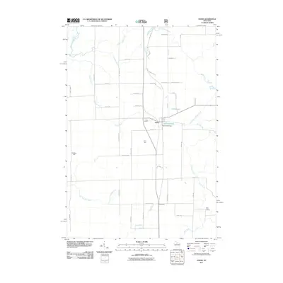
2011 Map of Ogema
USGS Topo · Published 2011About this map
Ogema sits at the heart of this Northwoods landscape, where the Ogema Millpond and Ogema E3247 Dam reflect the town's historical relationship with its local waterways. The terrain is defined by a dense network of drainage, including the South Fork Jump River and numerous named branches like Little Mondeaux Creek and North Branch Holmes Creek. The presence of the Pine Line Trl following the old rail grade suggests the region's transition from a timber-driven economy to a recreational one by the early 21st century.
Find a feature on this map
56 named features on this map. Tap any name to fly to it.
Don’t see what you’re looking for? This feature index may not catch every label — zoom into the map to look around manually.
Map Details
Editions of this 2011 Ogema Map
This is the sole edition of this map. No revisions or reprints were ever made.
Other maps of this area

1941 · Phillips
USGS Topo · 1:48,000

1941 · Brantwood
USGS Topo · 1:48,000

1943 · Philliips
USGS Topo · 1:48,000

1943 · Brantwood
USGS Topo · 1:48,000

1944 · Ogema
USGS Topo · 1:48,000

1945 · Rib Lake
USGS Topo · 1:48,000

1947 · Rib Lake
USGS Topo · 1:48,000

1947 · Ogema
USGS Topo · 1:48,000

1949 · Ogema
USGS Topo · 1:48,000

1949 · Rib Lake
USGS Topo · 1:48,000