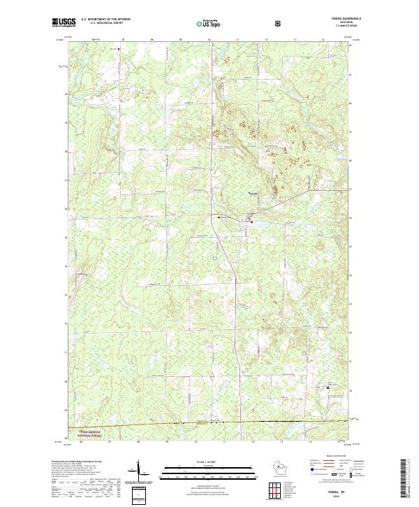
2022 Map of Ogema
USGS Topo · Published 2022About this map
Ogema serves as the central hub of this northern Wisconsin landscape, situated at the junction of Co Hwy G and Co Hwy C. The settlement's history is tied to its local waters, including the Ogema Millpond and the nearby headwaters of Holmes Cr. The surrounding terrain is a network of small tributaries and glacial features, such as Ottertail Springs and the winding course of the South Fork Jump River. To the south, the borders of the Chequamegon National Forest begin to define the landscape, where the elevation rises at Hallberg Hill. Local family history is preserved in several rural burial grounds, including Hillside Cem just west of the town center, and the more remote Will Cem and Levitt Creek Cem which sit near the edges of the township lines.
Find a feature on this map
68 named features on this map. Tap any name to fly to it.
Don’t see what you’re looking for? This feature index may not catch every label — zoom into the map to look around manually.
Map Details
Editions of this 2022 Ogema Map
This is the sole edition of this map. No revisions or reprints were ever made.
Other maps of this area

1941 · Phillips
USGS Topo · 1:48,000

1941 · Brantwood
USGS Topo · 1:48,000

1943 · Philliips
USGS Topo · 1:48,000

1943 · Brantwood
USGS Topo · 1:48,000

1944 · Ogema
USGS Topo · 1:48,000

1945 · Rib Lake
USGS Topo · 1:48,000

1947 · Rib Lake
USGS Topo · 1:48,000

1947 · Ogema
USGS Topo · 1:48,000

1949 · Ogema
USGS Topo · 1:48,000

1949 · Rib Lake
USGS Topo · 1:48,000