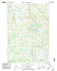
2005 Map of Ogema
USGS Topo · Published 2006About this map
Ogema serves as the focal point of this northern Wisconsin landscape, situated near the headwaters of the Mondeaux River and South Fork Jump River. The settlement pattern follows a grid of rural roads, many bearing family names like Hallstrand Road, Bjorklund Road, and Bergland Road, which reflect the area's pioneer heritage. Significant landmarks include the Ogema Millpond and Hillside Cem, while the southern reaches of the map transition into the Chequamegon-Nicolet National Forest within the Medford-Park Falls Ranger District.
Find a feature on this map
49 named features on this map. Tap any name to fly to it.
Don’t see what you’re looking for? This feature index may not catch every label — zoom into the map to look around manually.
Map Details
Editions of this 2005 Ogema Map
This is the sole edition of this map. No revisions or reprints were ever made.
Other maps of this area

1941 · Phillips
USGS Topo · 1:48,000

1941 · Brantwood
USGS Topo · 1:48,000

1943 · Philliips
USGS Topo · 1:48,000

1943 · Brantwood
USGS Topo · 1:48,000

1944 · Ogema
USGS Topo · 1:48,000

1945 · Rib Lake
USGS Topo · 1:48,000

1947 · Rib Lake
USGS Topo · 1:48,000

1947 · Ogema
USGS Topo · 1:48,000

1949 · Ogema
USGS Topo · 1:48,000

1949 · Rib Lake
USGS Topo · 1:48,000