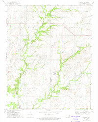
1972 Map of Oglesby
USGS Topo · Published 1974About this map
Hogshooter Creek and its many tributaries, including Curl Creek and Purgatory Creek, define the landscape of this Oklahoma territory during the early 1970s. The region is marked by significant resource extraction, shown through numerous oil wells, a Quarry, and a Shale Pit. The settlement of Oglesby serves as a local hub near the Oglesby Cem, while Glenoak sits further north along the county line. This survey captures a moment when the natural drainage patterns of the Jackson and Nowata townships were deeply intertwined with an active energy and mining industry. For those tracing family history, the inclusion of Willey Cem and residential clusters near Hogshooter provides valuable evidence of local settlement patterns before modern development altered the rural character of the border between Washington and Nowata Counties.
Find a feature on this map
15 named features on this map. Tap any name to fly to it.
Don’t see what you’re looking for? This feature index may not catch every label — zoom into the map to look around manually.
Map Details
Editions of this 1972 Oglesby Map
This is the sole edition of this map. No revisions or reprints were ever made.
Other maps of this area

1901 · Nowata
USGS Topo · 1:125,000

1914 · Nowata
USGS Topo · 1:125,000

1954 · Tulsa
USGS Topo · 1:250,000

1958 · Tulsa
USGS Topo · 1:250,000

1963 · Tulsa
USGS Topo · 1:250,000

1970 · Bartlesville SE
USGS Topo · 1:24,000
1970 · Talala
USGS Topo · 1:24,000
1971 · Bartlesville South
USGS Topo · 1:24,000
1971 · Bartlesville North
USGS Topo · 1:24,000

1972 · Blue Mound
USGS Topo · 1:24,000