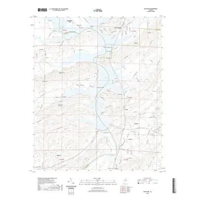
2020 Map of Ohatchee
USGS Topo · Published 2020About this map
H Neely Henry Lake and the winding course of the Coosa River define the geography of this region where Etowah, St. Clair, and Calhoun Counties meet. The landscape is characterized by prominent ridges such as the Beaver Creek Mountains and the Shoal Creek Mountains, which hem in narrow valleys like Slash Ham Valley and Shoal Creek Valley. This modern survey reveals the contemporary footprint of established communities like Ohatchee, Southside, and Rainbow City, while also marking the location of long-standing local landmarks. Genealogists will find significant value in the documentation of numerous burial sites, including Ohatchee Cem, Ten Island Cem, and Ragan Chapel Cem. The map provides a detailed record of water features from Woods Island to the smaller Cochran Springs, alongside the complex network of county roads like Co Rd 26 that connect these dispersed settlements and rural homesteads.
Find a feature on this map
126 named features on this map. Tap any name to fly to it.
Don’t see what you’re looking for? This feature index may not catch every label — zoom into the map to look around manually.
Map Details
Editions of this 2020 Ohatchee Map
This is the sole edition of this map. No revisions or reprints were ever made.
Other maps of this area

1889 · Springville
USGS Topo · 1:125,000

1892 · Springville
USGS Topo · 1:125,000

1900 · Anniston
USGS Topo · 1:125,000

1947 · Cox Gap
USGS Topo · 1:24,000

1947 · Dunaway Mountain
USGS Topo · 1:24,000

1947 · Ragland
USGS Topo · 1:62,500

1947 · Ragland
USGS Topo · 1:24,000

1947 · Glencoe
USGS Topo · 1:24,000

1947 · Wellington
USGS Topo · 1:24,000

1947 · Francis Mill
USGS Topo · 1:24,000