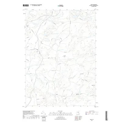
2019 Map of Ohio
USGS Topo · Published 2019About this map
West Canada Creek winds through the northern portion of this Herkimer County landscape, where the small settlements of Ohio and Gray anchor a network of local roads and watercourses. The map serves as a detailed record for genealogists, documenting numerous burial sites including Fairview Cem, Hurricane Cem, and McIntosh Cem scattered across the countryside. The geography is defined by a series of small lakes and valleys, such as Lake Tamarack, Little Deer Lake, and Thorp Vly, suggesting a terrain shaped by heavy glaciation. While much of the area remains rural and wooded, modern infrastructure appears in the form of the Kermizian Airport and a grid of secondary routes like Gray Wilmurt Rd and Ash Creek Rd. The presence of multiple named streams, including Little York Stream and Mounts Cr, points to a well-watered environment that has sustained these small upland communities into the present era.
Find a feature on this map
78 named features on this map. Tap any name to fly to it.
Don’t see what you’re looking for? This feature index may not catch every label — zoom into the map to look around manually.
Map Details
Editions of this 2019 Ohio Map
This is the sole edition of this map. No revisions or reprints were ever made.
Other maps of this area

1897 · Remsen
USGS Topo · 1:62,500

1898 · Utica
USGS Topo · 1:62,500

1900 · Little Falls
USGS Topo · 1:62,500

1900 · Utica
USGS Topo · 1:62,500

1900 · Remsen
USGS Topo · 1:62,500

1900 · Wilmurt
USGS Topo · 1:62,500

1902 · Wilmurt
USGS Topo · 1:62,500

1903 · Little Falls
USGS Topo · 1:62,500

1939 · Little Falls
USGS Topo · 1:62,500

1943 · Newport
USGS Topo · 1:24,000