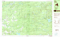
1989 Map of Ohio
USGS Topo · Published 1989About this map
West Canada Creek defines the northern reaches of this territory within the expansive Adirondack Park, where the hamlets of Ohio and Wilmurt Corners stand as the primary centers of settlement. The landscape is a dense network of water and high ground, featuring dozens of named water bodies such as Lake Tamarack, Curtis Lake, and Atwood Lake. The presence of Late Hall Clearing and California Clearing suggests the legacy of land management and logging in these forests, while Maurice E Luther Memorial Park provides a localized landmark near the creek's bend.
Find a feature on this map
63 named features on this map. Tap any name to fly to it.
Don’t see what you’re looking for? This feature index may not catch every label — zoom into the map to look around manually.
Map Details
Editions of this 1989 Ohio Map
This is the sole edition of this map. No revisions or reprints were ever made.
Other maps of this area

1897 · Remsen
USGS Topo · 1:62,500

1898 · Utica
USGS Topo · 1:62,500

1900 · Little Falls
USGS Topo · 1:62,500

1900 · Utica
USGS Topo · 1:62,500

1900 · Remsen
USGS Topo · 1:62,500

1900 · Wilmurt
USGS Topo · 1:62,500

1901 · Lassellsville
USGS Topo · 1:62,500

1902 · Wilmurt
USGS Topo · 1:62,500

1903 · Lassellsville
USGS Topo · 1:62,500

1903 · Little Falls
USGS Topo · 1:62,500