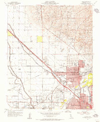
1954 Map of Oildale
USGS Topo · Published 1956About this map
Oildale and northern Bakersfield sit at the heart of this mid-century landscape, where the petroleum industry and a complex irrigation network define the valley floor. Vast extractive operations such as the Kern River Oil Field and Kern Front Oil Field dominate the surrounding hills and plains, marked by dense clusters of wells, tanks, and sumps. The area's transit and logistics hub is centered at Oil Junction and the Kern County Airport, while the Southern Pacific and Atchison Topeka and Santa Fe railroads provide the heavy infrastructure for moving the region's oil and agricultural output.
Find a feature on this map
52 named features on this map. Tap any name to fly to it.
Don’t see what you’re looking for? This feature index may not catch every label — zoom into the map to look around manually.
Map Details
Editions of this 1954 Oildale Map
4 editions found
Other maps of this area

1906 · Bakersfield
USGS Topo · 1:62,500

1910 · Buena Vista Lake
USGS Topo · 1:125,000

1912 · Buena Vista Lake
USGS Topo · 1:125,000

1914 · Caliente
USGS Topo · 1:125,000

1929 · Stevens
USGS Topo · 1:31,680

1929 · Fairfax School
USGS Topo · 1:31,680

1930 · Famoso
USGS Topo · 1:31,680

1930 · Rosedale
USGS Topo · 1:31,680

1930 · Oildale
USGS Topo · 1:31,680

1932 · North of Oildale
USGS Topo · 1:31,680