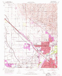
1954 Map of Oildale
USGS Topo · Published 1970About this map
The Kern Front Oil Field and Fruitvale Oil Field dominate this mid-century landscape north of Bakersfield, where the petroleum industry and extensive water management systems converge. The map illustrates a complex network of oil sumps, tanks, and pipelines interspersed with the essential water infrastructure of the San Joaquin Valley, including the Friant-Kern Canal, Beardsley Canal, and Lerdo Canal. Significant residential and industrial expansion is visible around Oildale, while smaller rail-aligned settlements like Saco and Prospero sit along the Southern Pacific tracks. Local social infrastructure is well-recorded through numerous educational sites such as Beardsley School, North High Sch, and Norris Sch. The inclusion of the County Airport and the Industrial Farm further reflects the region's diverse economic activities during this era of rapid California growth.
Find a feature on this map
50 named features on this map. Tap any name to fly to it.
Don’t see what you’re looking for? This feature index may not catch every label — zoom into the map to look around manually.
Map Details
Editions of this 1954 Oildale Map
4 editions found
Other maps of this area

1906 · Bakersfield
USGS Topo · 1:62,500

1910 · Buena Vista Lake
USGS Topo · 1:125,000

1912 · Buena Vista Lake
USGS Topo · 1:125,000

1914 · Caliente
USGS Topo · 1:125,000

1929 · Stevens
USGS Topo · 1:31,680

1929 · Fairfax School
USGS Topo · 1:31,680

1930 · Famoso
USGS Topo · 1:31,680

1930 · Rosedale
USGS Topo · 1:31,680

1930 · Oildale
USGS Topo · 1:31,680

1932 · North of Oildale
USGS Topo · 1:31,680