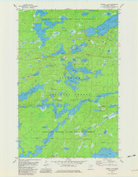
1981 Map of Ojibway Lake
USGS Topo · Published 1982About this map
The Boundary Waters Canoe Area Wilderness dominates this 1981 survey of northeastern Lake County, showing a complex network of glacial lakes and waterways interconnected by portage trails. The southern portion of the map is defined by the winding course of the Kawishiwi River, which flows through the Superior National Forest past a Gaging Station and several marked rapids.
Find a feature on this map
50 named features on this map. Tap any name to fly to it.
Don’t see what you’re looking for? This feature index may not catch every label — zoom into the map to look around manually.
Map Details
Editions of this 1981 Ojibway Lake Map
2 editions found
Other maps of this area

1954 · Two Harbors
USGS Topo · 1:250,000

1957 · Two Harbors
USGS Topo · 1:250,000

1957 · Gabbro Lake
USGS Topo · 1:62,500

1957 · Ensign Lake
USGS Topo · 1:62,500

1957 · Basswood Lake
USGS Topo · 1:62,500

1957 · Quetico
USGS Topo · 1:250,000

1958 · Two Harbors
USGS Topo · 1:250,000

1964 · Two Harbors
USGS Topo · 1:250,000

1968 · Quetico
USGS Topo · 1:250,000
1976 · Basswood Lake SW
USGS Topo · 1:24,000