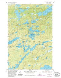
1981 Map of Ojibway Lake
USGS Topo · Published 1986About this map
Kawishiwi River flows through a complex network of glacial lakes and portage routes in this northern Minnesota landscape. This 1980s-era survey documents the intersection of the Superior National Forest and the Boundary Waters Canoe Area Wilderness. The map highlights a transition between road-accessible recreational points and protected wilderness, with Fernberg Road providing the primary corridor to several water access points. Notable landmarks for navigation include a public access site on Tofte Lake and a boat ramp on Ojibway Lake. The intricate hydrography includes smaller bodies such as Section Twelve Lake, Kammela Lake, and Uranus Lake, alongside larger systems like Moose Lake and Wood Lake. Several gravel pits and a gaging station on the river reflect the light infrastructure supporting this protected forest region.
Find a feature on this map
48 named features on this map. Tap any name to fly to it.
Don’t see what you’re looking for? This feature index may not catch every label — zoom into the map to look around manually.
Map Details
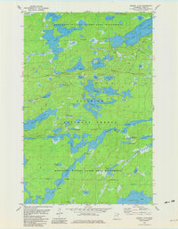
Editions of this 1981 Ojibway Lake Map
2 editions found
Other maps of this area

1954 · Two Harbors
USGS Topo · 1:250,000

1957 · Two Harbors
USGS Topo · 1:250,000

1957 · Gabbro Lake
USGS Topo · 1:62,500

1957 · Ensign Lake
USGS Topo · 1:62,500

1957 · Basswood Lake
USGS Topo · 1:62,500

1957 · Quetico
USGS Topo · 1:250,000

1958 · Two Harbors
USGS Topo · 1:250,000

1964 · Two Harbors
USGS Topo · 1:250,000

1968 · Quetico
USGS Topo · 1:250,000
1976 · Basswood Lake SW
USGS Topo · 1:24,000