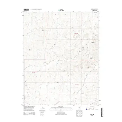
2013 Map of Ojito
USGS Topo · Published 2013About this map
Ojito sits within a dissected high-desert landscape in Rio Arriba County, defined by a network of deep drainage systems and ranching outposts. This 2013 survey illustrates the sparse settlement pattern of the region, where isolated locations like Huffman Ranch, Bechdol, and Colombo are connected by a web of county roads including Co Road 401 and Bechdol Rd. The terrain is dominated by significant relief, notably the prominent Tapicito Ridge and the winding course of Gavilan Canyon. Small water features such as Rucker Lake and the various tributaries of Sleeper Canyon provide vital points of interest in an otherwise arid environment. This map captures the intersection of public lands and private holdings, showing the late 20th-century road infrastructure that serves these remote northern New Mexico communities and grazing lands.
Find a feature on this map
26 named features on this map. Tap any name to fly to it.
Don’t see what you’re looking for? This feature index may not catch every label — zoom into the map to look around manually.
Map Details
Editions of this 2013 Ojito Map
This is the sole edition of this map. No revisions or reprints were ever made.
Other maps of this area

1889 · Largo
USGS Topo · 1:250,000

1895 · Largo
USGS Topo · 1:250,000

1909 · Gallina
USGS Topo · 1:125,000

1954 · Aztec
USGS Topo · 1:250,000

1955 · Llaves
USGS Topo · 1:62,500

1955 · Boulder Lake
USGS Topo · 1:62,500

1958 · Aztec
USGS Topo · 1:250,000

1962 · Aztec
USGS Topo · 1:250,000

1963 · Schmitz Ranch
USGS Topo · 1:24,000

1963 · Lindrith
USGS Topo · 1:24,000