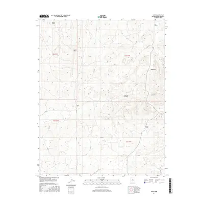
2017 Map of Ojito
USGS Topo · Published 2017About this map
Ojito and the small settlement of Tapicitoes sit within the high desert landscape of Rio Arriba County, defined by a complex network of canyons and ridges. This 2017 survey illustrates a terrain deeply etched by seasonal water flow, with features such as Sleeper Canyon, Bear Canyon, and the sprawling Cañon de los Ojitos carving through the elevation. The prominent Tapicito Ridge dominates the northern section, while the Murrow Field on the Divide Airport provides a solitary hub for aviation amidst the remote county road network, including Co RD 402 and Co RD 401. The map reveals a land usage pattern dictated by topography, where travel and habitation follow the natural breaks of the Gavilan Canyon and Cañoncito de las Lleguas.
Find a feature on this map
22 named features on this map. Tap any name to fly to it.
Don’t see what you’re looking for? This feature index may not catch every label — zoom into the map to look around manually.
Map Details
Editions of this 2017 Ojito Map
This is the sole edition of this map. No revisions or reprints were ever made.
Other maps of this area
1889 · Largo
USGS Topo · 1:250,000
1895 · Largo
USGS Topo · 1:250,000
1909 · Gallina
USGS Topo · 1:125,000

1954 · Aztec
USGS Topo · 1:250,000
1955 · Llaves
USGS Topo · 1:62,500
1955 · Boulder Lake
USGS Topo · 1:62,500
1958 · Aztec
USGS Topo · 1:250,000
1962 · Aztec
USGS Topo · 1:250,000
1963 · Schmitz Ranch
USGS Topo · 1:24,000
1963 · Lindrith
USGS Topo · 1:24,000