
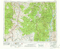
1954 Map of Okanogan
USGS Topo · Published 1964About this map
Oroville and the agricultural lands of the northern valley anchor this mid-century survey of North Central Washington. The map details a landscape where the river-and-rail economy of the Great Northern railroad supports settlements like Tonasket and Okanogan. To the east, the rugged terrain of the Colville National Forest and the Kettle River Range is marked by active mining sites including the Mountain Lion Mine and Knob Hill Mine. The expansive Colville Indian Reservation dominates the southern half of the sheet, containing the waters of Omak Lake and the community of Nespelem. A significant transformation of the landscape is visible along the eastern edge, where the Columbia River swells into Franklin D. Roosevelt Lake, creating a new shoreline and altering the geography around Inchelium and Marcus.
Find a feature on this map
57 named features on this map. Tap any name to fly to it.
Don’t see what you’re looking for? This feature index may not catch every label — zoom into the map to look around manually.
Map Details
Editions of this 1954 Okanogan Map
2 editions found
Other maps of this area

1899 · Methow
USGS Topo · 1:125,000

1901 · Chelan
USGS Topo · 1:125,000

1901 · Methow
USGS Topo · 1:125,000

1902 · Osoyoos
USGS Topo · 1:125,000

1904 · Osoyoos
USGS Topo · 1:125,000

1904 · Republic
USGS Topo · 1:125,000

1905 · Okanogan
USGS Topo · 1:125,000

1906 · Chopaka
USGS Topo · 1:125,000

1927 · Chewelah
USGS Topo · 1:125,000

1929 · Colville
USGS Topo · 1:125,000