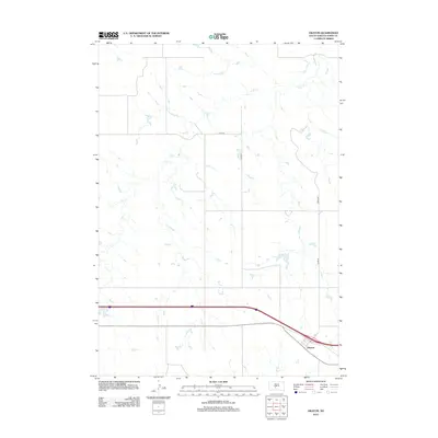
2012 Map of Okaton
USGS Topo · Published 2012About this map
Okaton anchors the southeastern corner of this Jones County landscape, situated along the primary east-west transportation corridor. The surrounding terrain is defined by an intricate network of drainage patterns, dominated by the winding path of Dry Cr as it meanders through the central and northern sections of the quadrangle. This 2012 survey illustrates the sparse, rural nature of the High Plains, where human presence is primarily marked by a rigid grid of section-line roads and specialized routes like Co Rd-N5 and 282nd Ave. The geographic layout highlights the vast distances between settlements in this portion of South Dakota, where the local economy and infrastructure are tied closely to the highway and the natural flow of seasonal waterways across the open prairie.
Find a feature on this map
6 named features on this map. Tap any name to fly to it.
Don’t see what you’re looking for? This feature index may not catch every label — zoom into the map to look around manually.
Map Details
Editions of this 2012 Okaton Map
This is the sole edition of this map. No revisions or reprints were ever made.
Other maps of this area

1951 · Capa
USGS Topo · 1:24,000

1951 · Stamford SE
USGS Topo · 1:24,000

1951 · Okaton SW
USGS Topo · 1:24,000

1951 · Okaton SE
USGS Topo · 1:24,000

1951 · Capa SE
USGS Topo · 1:24,000

1954 · Midland SE
USGS Topo · 1:24,000

1954 · Pierre
USGS Topo · 1:250,000

1955 · Martin
USGS Topo · 1:250,000

1958 · Pierre
USGS Topo · 1:250,000

1958 · Martin
USGS Topo · 1:250,000