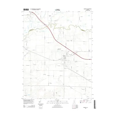
2015 Map of Okawville
USGS Topo · Published 2015About this map
Okawville serves as the central hub of this Southern Illinois landscape, positioned where local roads and rails intersect south of the Kaskaskia River. The map reveals a dense distribution of family and fraternal burial grounds, including the Independent Order of Oddfellows Cem and several smaller sites like Staude Cem and Neunlist Cem, which reflect the deep-rooted genealogical history of Washington and Clinton Counties.
Find a feature on this map
98 named features on this map. Tap any name to fly to it.
Don’t see what you’re looking for? This feature index may not catch every label — zoom into the map to look around manually.
Map Details
Editions of this 2015 Okawville Map
This is the sole edition of this map. No revisions or reprints were ever made.
Other maps of this area

1906 · Breese
USGS Topo · 1:62,500

1907 · Breese
USGS Topo · 1:62,500

1910 · Carlyle
USGS Topo · 1:62,500

1910 · Okawville
USGS Topo · 1:62,500

1931 · Hoyleton
USGS Topo · 1:48,000

1932 · Nashville
USGS Topo · 1:62,500

1936 · Nashville
USGS Topo · 1:62,500

1940 · Okawville
USGS Topo · 1:62,500

1948 · Carlyle
USGS Topo · 1:62,500
1957 · Venedy
USGS Topo · 1:24,000