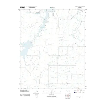
2010 Map of Okmulgee Lake
USGS Topo · Published 2010About this map
Okmulgee Lake serves as a central hydrological feature in this portion of Oklahoma, defined by its complex shoreline including Lions Point, Carpenters Point, and Seascout Point. The 2010 landscape reveals a pattern of rural development around the settlement of Wilson, with a grid of section line roads such as S 180 RD and E 1040 RD providing access to local landholdings. The presence of multiple reservoirs, including the Salt Creek Site S-1 Reservoir and the numerically designated Oknoname 111006 Reservoir, reflects a decades-long regional focus on water management and conservation. Genealogists and local historians will find several burial sites preserved among the fields and creek beds, notably the Sharp Cemetery, Edwards Cemetery, and the Indian Cemetery. The map also captures the critical infrastructure of the Okmulgee Waterworks near the banks of the Deep Fork, illustrating how the drainage of Honey Creek and Fourmile Creek supports the local community.
Find a feature on this map
44 named features on this map. Tap any name to fly to it.
Don’t see what you’re looking for? This feature index may not catch every label — zoom into the map to look around manually.
Map Details
Editions of this 2010 Okmulgee Lake Map
This is the sole edition of this map. No revisions or reprints were ever made.
Other maps of this area

1896 · Okmulgee
USGS Topo · 1:125,000

1900 · Canadian
USGS Topo · 1:125,000

1900 · Wewoka
USGS Topo · 1:125,000

1900 · Okmulgee
USGS Topo · 1:125,000

1901 · Nuyaka
USGS Topo · 1:125,000

1946 · Fort Smith
USGS Topo · 1:250,000

1954 · Oklahoma City
USGS Topo · 1:250,000

1957 · Oklahoma City
USGS Topo · 1:250,000

1962 · Henryetta
USGS Topo · 1:24,000

1963 · Oklahoma City
USGS Topo · 1:250,000