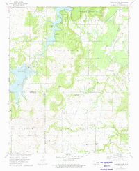
1973 Map of Okmulgee Lake
USGS Topo · Published 1976About this map
Okmulgee Lake dominates this 1970s landscape, its irregular shoreline defined by points and coves like Lions Point and Salvation Army Cove. The map documents a territory where outdoor recreation and heavy industry coexist, with the Okmulgee State Recreation Area and Okmulgee State Game Management Area bordering active oil fields. This coexistence is visible in the network of service roads and numerous oil wells that punctuate the wooded hills of Tiger and Lester.
Find a feature on this map
32 named features on this map. Tap any name to fly to it.
Don’t see what you’re looking for? This feature index may not catch every label — zoom into the map to look around manually.
Map Details
Editions of this 1973 Okmulgee Lake Map
This is the sole edition of this map. No revisions or reprints were ever made.
Other maps of this area

1896 · Okmulgee
USGS Topo · 1:125,000

1900 · Canadian
USGS Topo · 1:125,000

1900 · Wewoka
USGS Topo · 1:125,000

1900 · Okmulgee
USGS Topo · 1:125,000

1901 · Nuyaka
USGS Topo · 1:125,000

1946 · Fort Smith
USGS Topo · 1:250,000

1954 · Oklahoma City
USGS Topo · 1:250,000

1957 · Oklahoma City
USGS Topo · 1:250,000

1962 · Henryetta
USGS Topo · 1:24,000

1963 · Oklahoma City
USGS Topo · 1:250,000