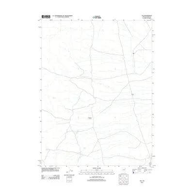
2012 Map of Ola
USGS Topo · Published 2012About this map
Ola sits as a lonely outpost in the high desert of Elko County, marking a sparse landscape where water dictates the pattern of human presence. This 2012 U. S. Geological Survey topographic study shows how vital scattered water sources remain in this arid region, with names like Blue Bell Spring, Hillside Spring, Elizabeth Spring, and Mud Spring indicating the few points where life and livestock can find relief. The terrain is characterized by broad basins punctuated by features such as Erickson Canyon, while the presence of the Wendover Corral suggests the continued importance of open-range cattle ranching in this part of Nevada. The map captures the delicate balance between the rugged topography and the thin network of unpaved roads and trails that connect these isolated landmarks.
Find a feature on this map
7 named features on this map. Tap any name to fly to it.
Don’t see what you’re looking for? This feature index may not catch every label — zoom into the map to look around manually.
Map Details
Editions of this 2012 Ola Map
This is the sole edition of this map. No revisions or reprints were ever made.
Other maps of this area

1955 · Elko
USGS Topo · 1:250,000

1958 · Elko
USGS Topo · 1:250,000

1962 · Elko
USGS Topo · 1:250,000

1965 · Elko
USGS Topo · 1:250,000

1971 · West Morris Basin
USGS Topo · 1:24,000

1971 · Pilot
USGS Topo · 1:24,000

1971 · Leppy Peak
USGS Topo · 1:24,000

1972 · Morgan Pass
USGS Topo · 1:24,000

1972 · Lion Spring
USGS Topo · 1:24,000

1972 · Ola
USGS Topo · 1:24,000