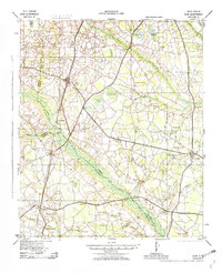
1943 Map of Olar
USGS Topo · Published 1982About this map
The Salkehatchie River and Little Salkehatchie River basins define this portion of the South Carolina Lowcountry, where an intricate network of wetlands like Brunston Swamp and Sutton Bay weave through the rural landscape. In the early 1940s, the economy and social life of this region were anchored by a high density of country schools and churches, such as Kearse Chapel and Rosemary Sch, serving family-run farms and timberlands.
Find a feature on this map
57 named features on this map. Tap any name to fly to it.
Don’t see what you’re looking for? This feature index may not catch every label — zoom into the map to look around manually.
Map Details
Editions of this 1943 Olar Map
2 editions found

Other maps of this area

1918 · Varnville
USGS Topo · 1:62,500

1919 · Olar
USGS Topo · 1:62,500

1919 · Bamberg
USGS Topo · 1:48,000

1919 · Allendale
USGS Topo · 1:62,500

1919 · Cummings
USGS Topo · 1:62,500

1919 · Lodge
USGS Topo · 1:62,500

1920 · Lodge
USGS Topo · 1:48,000

1920 · Bamberg
USGS Topo · 1:62,500

1920 · Peeples
USGS Topo · 1:62,500

1920 · Orangeburg
USGS Topo · 1:48,000