
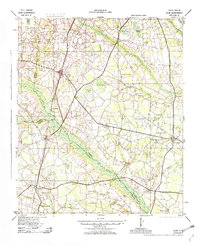
1943 Map of Olar
USGS Topo · Published 1943About this map
Olar and Ehrhardt anchor this 1943 survey, which reveals a landscape of dispersed agricultural communities and rural school districts during the Second World War. The area is defined by the broad, marshy corridors of the Salkehatchie River and Little Salkehatchie River, where numerous "bays" and swamps like Alligator Bay and Brunson Swamp break up the cultivated uplands. The Seaboard Air Line railroad provides a clear industrial axis through the territory, connecting settlements like Govan, Schofield, and Ulmers.
Find a feature on this map
71 named features on this map. Tap any name to fly to it.
Don’t see what you’re looking for? This feature index may not catch every label — zoom into the map to look around manually.
Map Details
Editions of this 1943 Olar Map
2 editions found
Other maps of this area

1918 · Varnville
USGS Topo · 1:62,500

1919 · Olar
USGS Topo · 1:62,500

1919 · Bamberg
USGS Topo · 1:48,000

1919 · Allendale
USGS Topo · 1:62,500

1919 · Cummings
USGS Topo · 1:62,500

1919 · Lodge
USGS Topo · 1:62,500

1920 · Lodge
USGS Topo · 1:48,000

1920 · Bamberg
USGS Topo · 1:62,500

1920 · Peeples
USGS Topo · 1:62,500

1920 · Orangeburg
USGS Topo · 1:48,000