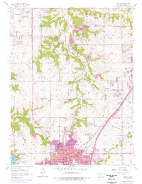
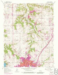
1956 Map of Olathe
USGS Topo · Published 1976About this map
The growing community of Olathe anchors this mid-century survey of Johnson County, showing the town's expansion toward Lenexa and Lackmans. This edition captures a significant period of suburban transition, where purple-tinted urban updates overlap the traditional rural landscape of Monticello and Shawnee. Notable for its record of local education and social infrastructure, the map identifies several rural schoolhouses such as Meadowlane Sch, Mt Zion Sch, and Sunlight Sch, alongside the prominent Grange Hall.
Find a feature on this map
37 named features on this map. Tap any name to fly to it.
Don’t see what you’re looking for? This feature index may not catch every label — zoom into the map to look around manually.
Map Details
Editions of this 1956 Olathe Map
5 editions found
Other maps of this area

1887 · Olathe
USGS Topo · 1:125,000

1890 · Kansas City
USGS Topo · 1:125,000

1893 · Olathe
USGS Topo · 1:125,000

1894 · Kansas City
USGS Topo · 1:125,000

1934 · Bonner Springs
USGS Topo · 1:48,000

1934 · Shawnee
USGS Topo · 1:24,000

1934 · Edwardsville
USGS Topo · 1:24,000

1935 · Olathe
USGS Topo · 1:24,000

1935 · Lenexa
USGS Topo · 1:24,000

1940 · Bonner Springs
USGS Topo · 1:62,500